
There are no weather parameters (forecasts) in Pflotsh Beach that are not available in Pflotsh ECMWF.
Pflotsh Beach shows weather forecasts worldwide. A swipe, a zoom or a search for a place gets you everywhere.
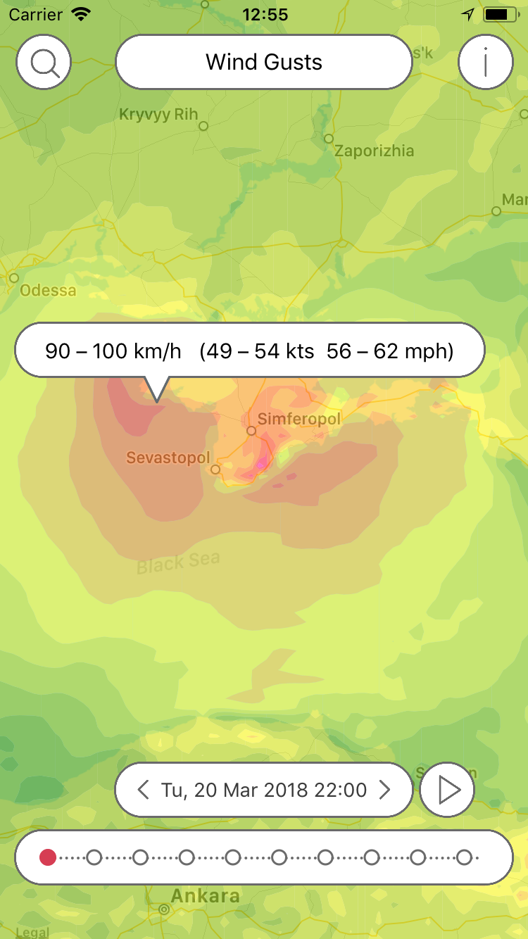
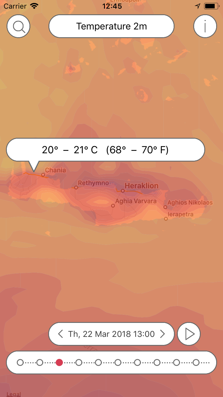
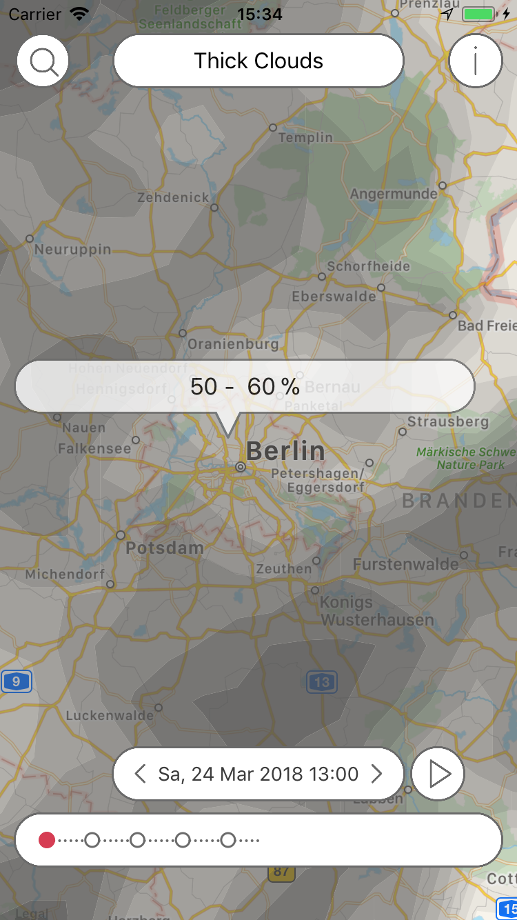
By tapping on the map, the relevant values are displayed. You can get more information about these values by touching the "i".
In addition to the latest forecasts, previous forecasts are also available. By entering the date and time, the past can be displayed.
Download


Subscription
In order to cover the cost for the data and the further development of the app there is yearly amount to be paid via subscription. The first month is free and you can cancel the subscription without being charged during the first month of use. Buying a Pflotsh ECMWF subscription also unlocks to all other Pflotsh apps, if they are installed on the same device.
Take a look at the subscription information.
Q&A
1. Why do I need this app?
Stay informed about the leisure and holiday weather. Worldwide.
2. Why there are several Pflotsh apps and not just one?
The various apps are focussed on specific purposes. They have different functionalities, and contain a different selection of weather parameters and models. If all apps were combined to one single app, that one would be rather confusing with too many options getting into the user's way. The individual apps each show exactly what is required for a specific purpose. See all Pflotsh apps at a glance.
3. What is the ECMWF weather model?
The ECMWF aka "Euro model" is the best weather forecast model worldwide being standard for all important decision.
4. What is the resolution of the weather model?
The App uses the ECMWF with a ca. 9x9 km resolution.
5. Why are maps always the main view in the all Pflotsh apps?
A weather map provides a lot more information than weather data for just one location. E.g: If you want to take a picture of a mountain, it is not important if the sky above you is cloudless, you want to know if the subject is hidden in fog. And anyone who is on the move wants to know how the weather is developing along the way.
6. How do I choose which weather parameter is displayed?
Tap the button bar at the top center of the screen. Select the desired parameter (see also select in the Tips and Tricks section). It may take a moment for the data to load.
7. What does "significant weather" mean?
Significant weather shows those things that may be dangerous or annoying in the forecast – mostly precip, also storms or fog.
8. While I am panning or zooming, the data is not shown. Why?
In order to see the map. Data is drawn with little transparency, so that it is visible well and without interference with the map. However, in some cases, you won’t see the map well enough. In those cases, just pan.
9. Why do I sometimes only see a map?
Either there is no significant weather in your area or there is the unlikely possibility that one of our servers is down. Try an other parameter or check back past events via the archive function (star icon).
10. How do I toggle between map and satellite view?
Go to the menu and touch "Settings". You can then customize the map type.
11. What do the dots at the bottom of the screen mean?
They help with the orientation in time (see also Timeline in Tips and Tricks). You can swipe your finger or tap to select a point in time. Or you can set a date by date, even if it is in the past.
12. Why do I sometimes see more and sometimes less dots?
For the first four days, the ECMWF calculates its forecasts hourly for most parameters. For a period of up to six days the forecasts are provided in three-hour intervals, then at six hours. For some parameters the forecasts are less frequent.
13. How do I choose the date and time which I need information for?
Please tap on the date display in the center and choose date and time and confirm your choice via check mark. You can also tap the arrows to the left (to the past) or right (to the future).
14. How do I get immediately to the present time and my place?
Shake your phone! Alternatively, select the corresponding item from the menu.
15. How do I update the data for the place I am currently seeing?
Long press the date display. Alternatively, select the corresponding item from the menu.
16. Why is there no legend to the colours and icons?
You won’t need that, just get all your info by tapping on the screen (see also Information about Colors).
17. Which operating systems work with Pflotsh storm?
It works from iPhone 5 or iPad from iOS 10.0 or higher, Android from version 4.4 (KitKat).
18. Why do I have to pay for the app?
In order to cover the cost for the data and the further development of the app there is yearly amount to be paid via subscription. The first month is free and you can cancel the subscription without being charged during the first month of use. Buying a Pflotsh ECMWF subscription also unlocks to all other Pflotsh apps, if they are installed on the same device.
19. What can't the app do for you?
This app is not intended to replace official warnings by the National Weather Services of the countries involved, but it is a perfect supplement if you want to assess the weather situation for yourself.
 @pflotsh,
or send us an email
@pflotsh,
or send us an email  support@pflotsh.com. We are looking forward to your feedback.